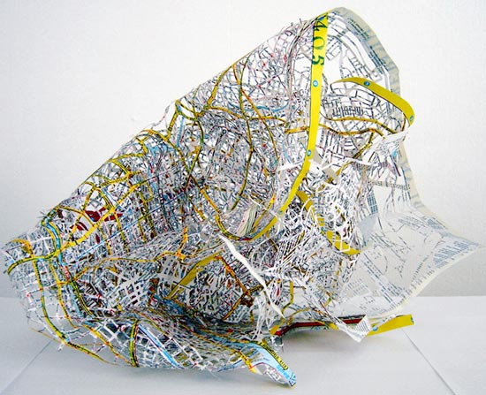
‘plan berlin’, cut out map by cannelle tanc, 2006 currently on show at http://www.ampersandintlarts.com/exhibitions.html


‘road circle’ and ‘map circle’ (constructions with map pieces), by chris kenny, 2007


‘map of the world’ by stefana mcclure, 2005-06


‘prevailing winds’ and here lies russia’ by gabrielle teschner


‘south london arteries’ by susan stockwell, 2002
 hand-held subway by nina katchadourian cibachrome, 13 x 19 inches, 1996 dissected paper map of the new york subway system.
 ‘map dissection I’ by nina katchadourian cut paper map, glass and hardware, 24 x 36 x .5 inches, 1991/1997

a AAA road map of the USA, removing all the land and leaving only the connected road network. the map was sandwiched between two large pieces of glass and suspended.

a second dissection was made of an identical map, extracting those places were the roads came together to form small knots or clusters and placing them between glass microscope slides. Many of these extractions became quite figurative.

KEEP UP WITH OUR DAILY AND WEEKLY NEWSLETTERS
MAP ART AND DESIGN (56)
 Jul 23, 2023
 Jul 29, 2022
 Nov 06, 2021
 Jun 13, 2021
 May 30, 2021
PRODUCT LIBRARY
 Apr 19, 2024
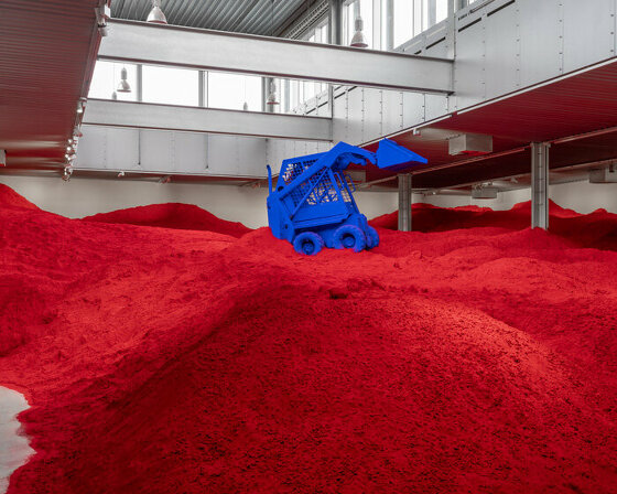
with behemoth installations, scandinavia's largest exhibition of anish kapoor's works opens at ARKEN museum.
connections: +390
 Apr 17, 2024
we're getting ready for the pre-opening launching today until friday, with public access scheduled for the 20th.
connections: 12
 Apr 09, 2024
designboom speaks with french artist JR about la nascita, his new monumental rock installation just outside milan central station.
 Mar 27, 2024
the 'poet of iron', as dubbed by his colleagues, passed away at his home in orient, new york, after a battle with pneumonia.
connections: +110