team at moovellab find out if all roads actually do lead to rome
all images courtesy of moovellab
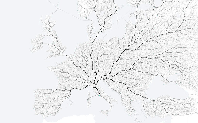
multi-disciplinary creative office moovellab was really curious if all roads actually do lead to rome. research associate for speculative and computational design benedikt groß took it upon himself to find out with help of digital geography and urbanism expert raphael reimann and computational and interaction designer philipp schmitt to find out if it’s true with series called ‘roads to rome‘. together they created maps using open source openstreetmap data and route calculator called graphhopper.
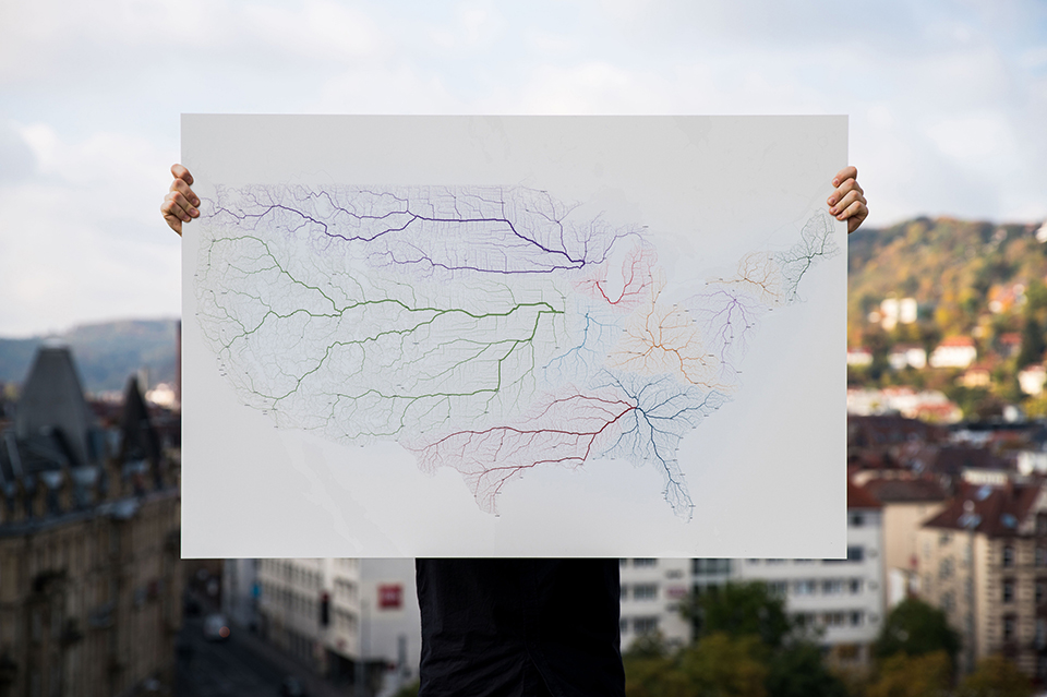
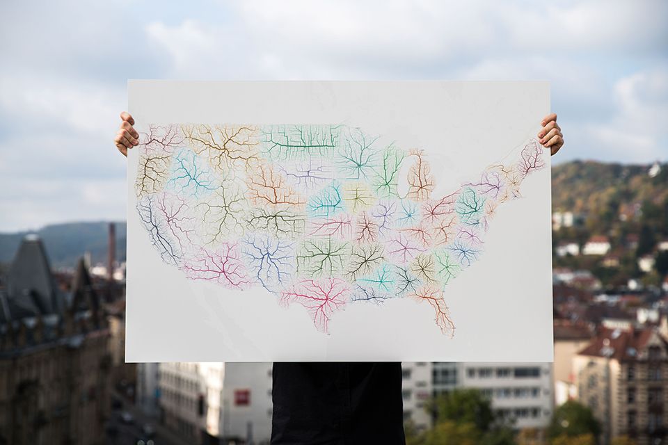
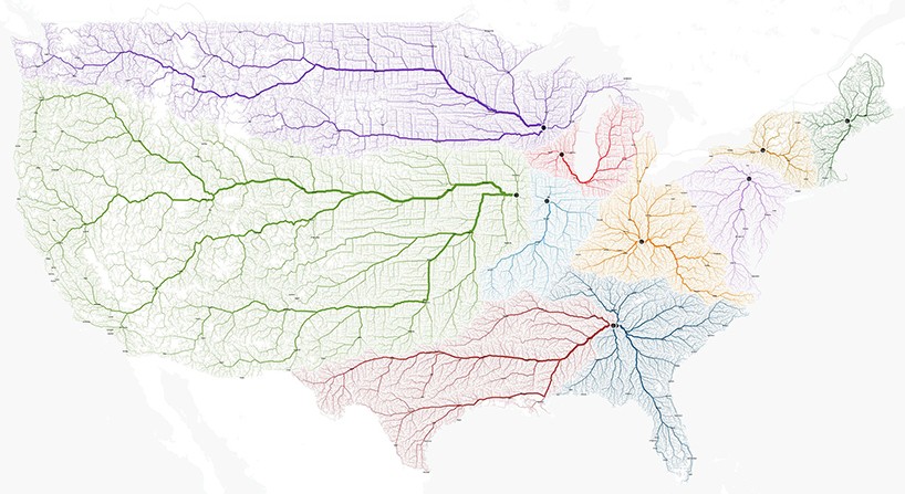 map displaying all roads to all 11 towns and cities called rome in the united states
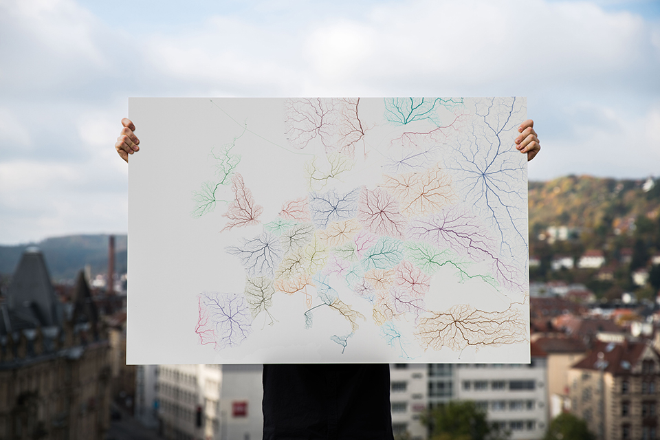
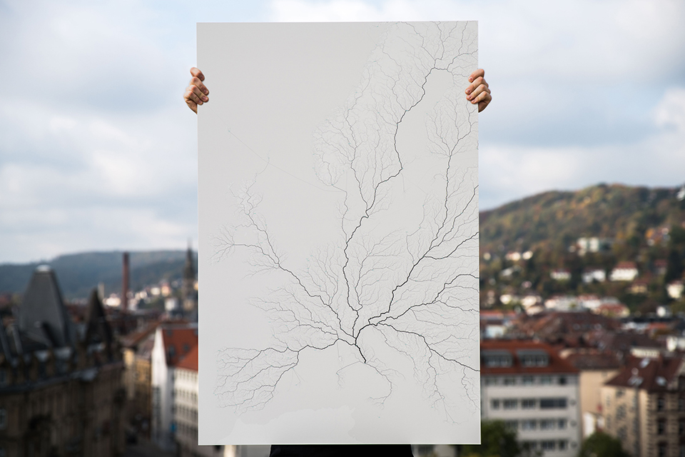
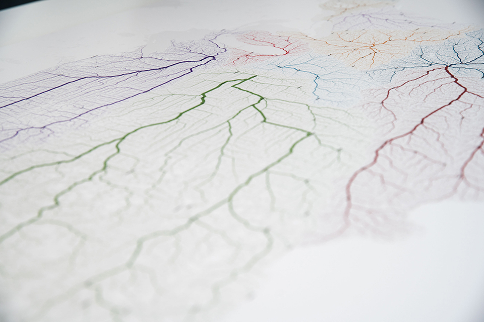
they aligned starting points in a 26,503,452 square kilometer grid covering all of europe. each cell of the grid contained the one starting point to rome. once they got 486,713 starting points, they needed to find out how they could reach the city. for that they created an algorithm that calculated 3,375,746 routes with bolder lines representing streets used more often. the result is somewhere between information visualization and data art, a mobility unveiling at a very large scale. employing the unique software created, the team also displayed all roads that lead to every major european and american city, as well as all roads that lead to towns and cities called rome too.
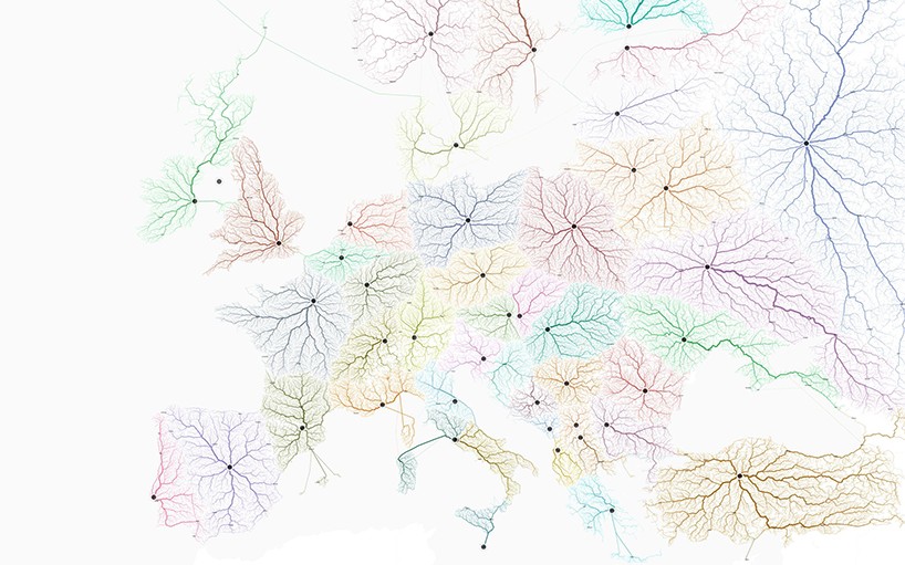 moovellab map showcasing roads to every major european city
 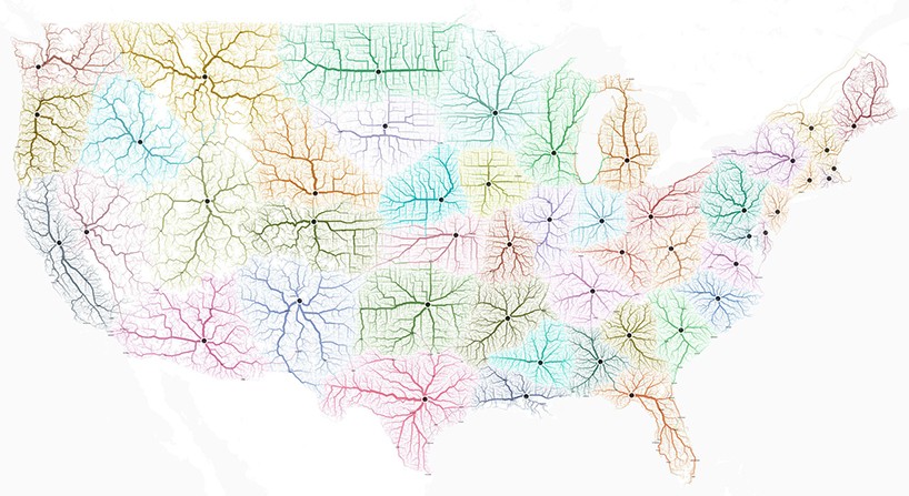 roads to popular american cities
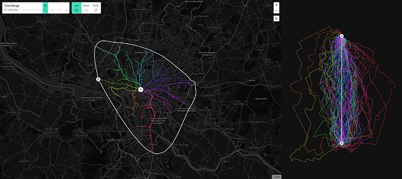 custom software to visualised all the routes
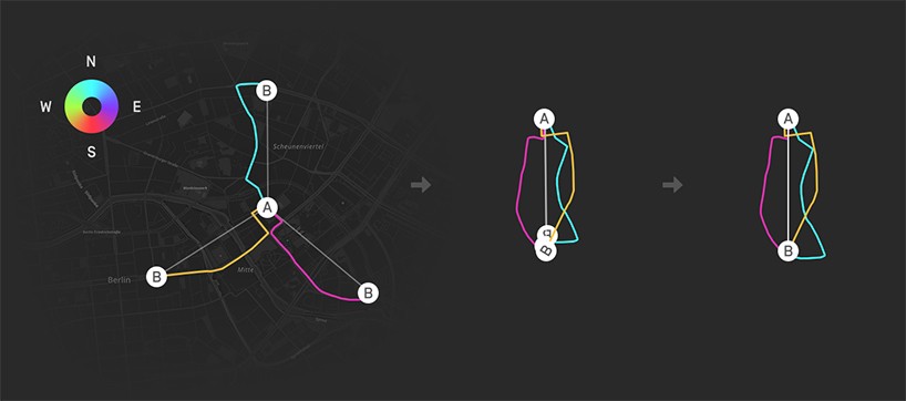 the algorithm to find the travel paths


 Mar 04, 2026
 Feb 26, 2026
 Feb 23, 2026
 Feb 14, 2026