
seaBED underwater robot develops new 3D data maps of antarctic ice
image courtesy of klaus meiners/woods hole oceanographic institution
the ‘seaBED’ underwater robot has developed the first detailed and high-resolution 3D maps of antarctic sea ice, to provide accurate thickness measurements for areas previously thought too difficult to access. initiated by scientists from the UK, USA and australia, the autonomous underwater vehicle (AUV) increases the research pace aimed at understanding the context of climate change. challenges in accessing thicker places of the floe had previously left gaps in experts’ data, but with the ‘seaBED’ tool, the missing information was concluded.
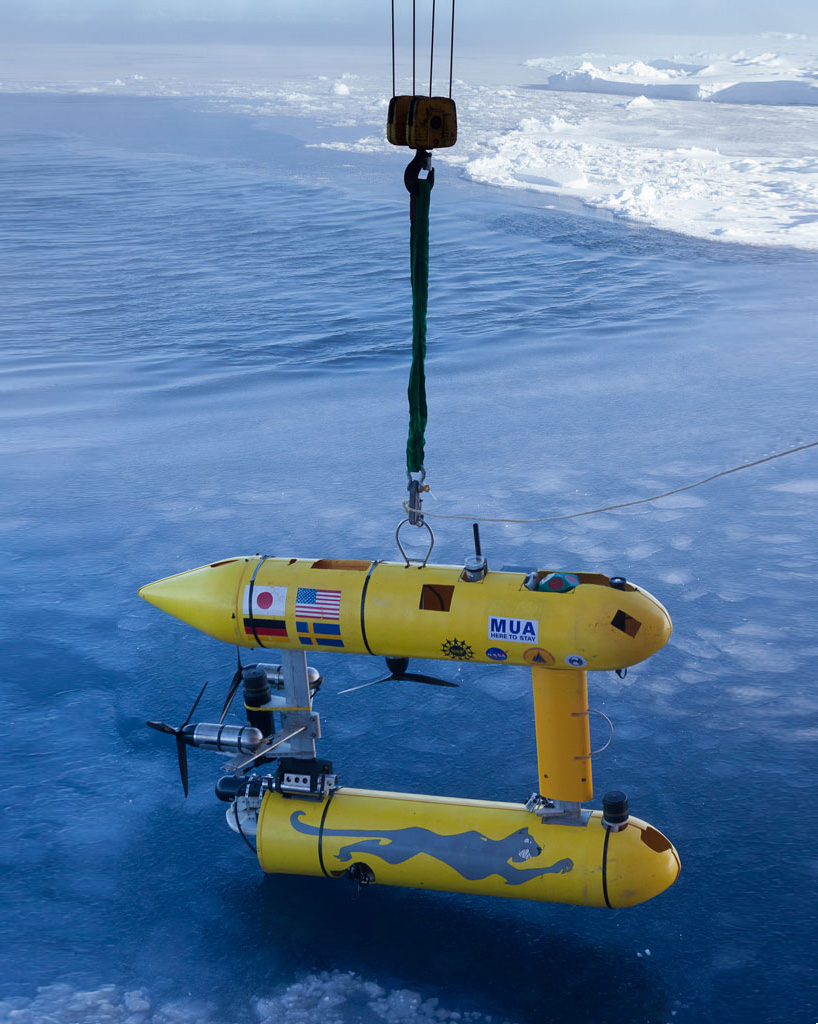
the two-twin hull robot
image courtesy of p.kimball/woods hole oceanographic institution
‘putting an AUV together to map the underside of sea ice is challenging from a software, navigation and acoustic communications standpoint,’ says hanumant singh, an engineering scientist at the woods hole oceanographic institution.
the AUV being lowered off the stern in 2012
image courtesy of wendy pyper
‘seaBED’s maneuverability and stability made it ideal for this application where we were doing detailed floe-scale mapping and deploying, as well as recovering in close-packed ice conditions. it would have been tough to do many of the missions we did, especially under the conditions we encountered, with some of the larger vehicles.’
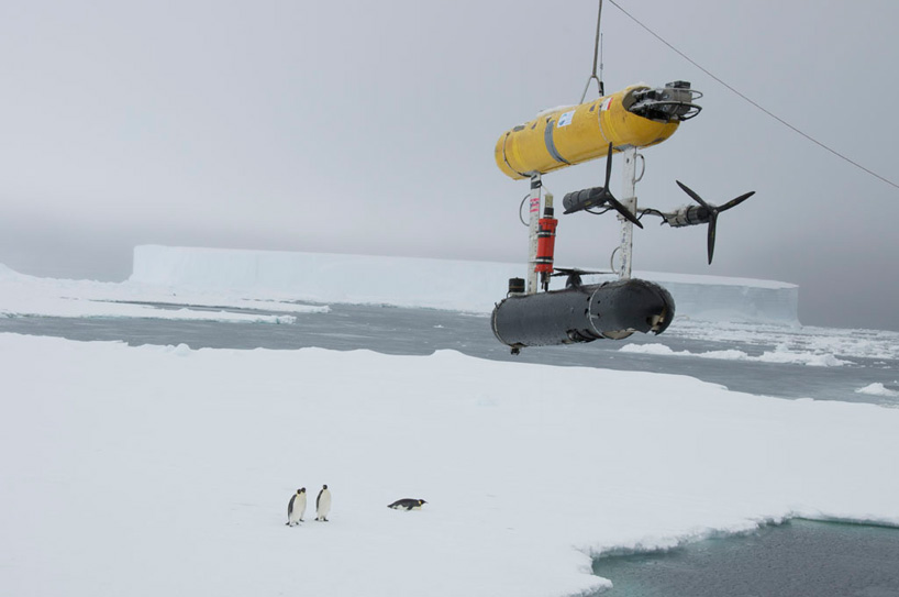
image courtesy of h.singh/woods hole oceanographic institution
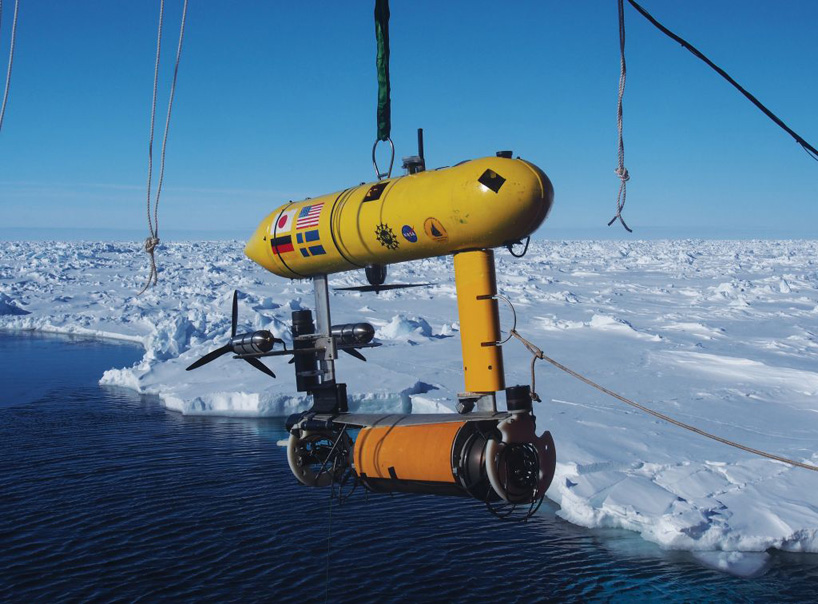
fitted with an upward-looking sonar in order to measure and map the underside of the ice, the ‘seaBED’ underwater robot operates at a depth of 20 to 30 meters and has a twin-hull design to enhance stability for low-speed photographic surveys. deployed as part of two cruises in 2010 and 2012, three locations around the antarctic peninsula were analyzed and combined with airborne measurements to vastly improve estimates of icicle volume.
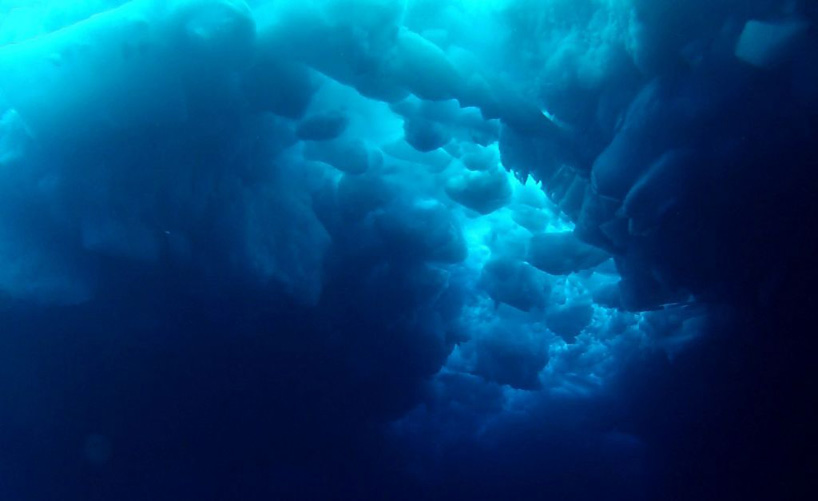
the upward facing sonar devices were able to map the underside of the ice
image courtesy of ROV team
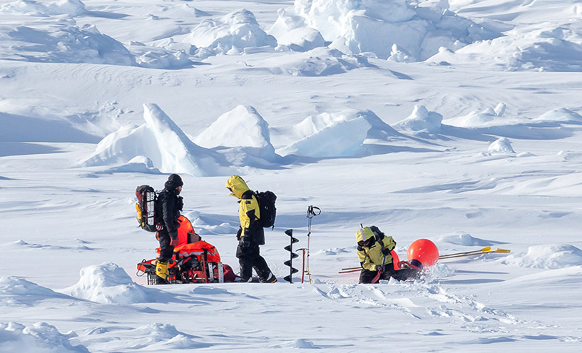
image courtesy of p.kimball/woods hole oceanographic institution
underwater robot sheds new light on antarctic sea ice
video courtesy of antarctic survey
ROBOTS (529)
 Mar 19, 2024
 Mar 04, 2024
 Feb 06, 2024
PRODUCT LIBRARY
 Mar 21, 2024
 Mar 13, 2024
 Feb 24, 2024
 Feb 07, 2024