touch-responsive 3D maps provide navigation to visually impaired
images courtesy of university of buffalo
developed by a team from the university of buffalo’s center for inclusive design and environmental access (IDeA), touch-responsive 3D maps provide an interactive navigation experience to the visually impaired. in partnership with touch graphics inc, they have built and tested a new kind of way-finder that vocalizes information and directions when felt. this helps the visually impaired visitors navigate independently around public spaces such as museums, and more specifically, those at the latest installation at perkins school for the blind in massachusetts.
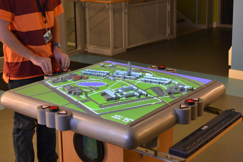
the maps are horizontal so that users can feel the 3D world as they would in real life
‘it’s really about giving this audience, this population, a way to understand their environment,’ says IDeA center researcher heamchand subryan, who led the project with IDeA center director edward steinfeld, ArchD, and touch graphics president steve landau. ‘we’re providing a level of information that allows them to navigate their environment easily, without help, which gives them a sense of independence.’
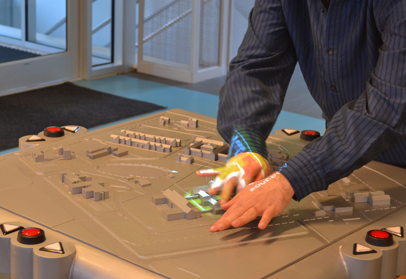
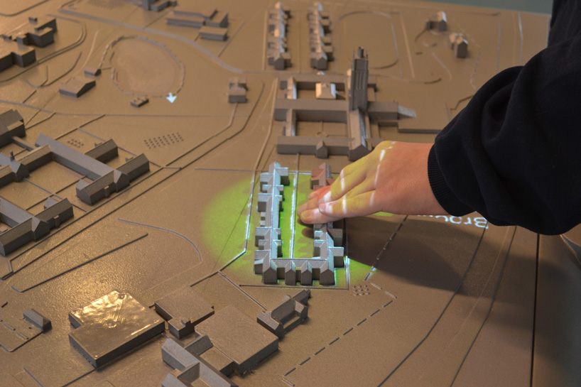
a projector above the perkins installation shines a spotlight on buildings when they are touched
‘the touch-responsive models solve the ‘last mile’ problem for blind pedestrians, who can often navigate to a building or campus address using GPS, but then need help to get to the classroom building or doctor’s office where they need to be,’ landau says.
coated in conductive paint, the buildings sense pressure when touched
the interactive 3D plans use conductive paint so that as guests explore the model with their hands, the miniature buildings can sense pressure to know when to announce its name and the directions to get there. as well, the sound effects embedded in the landscape, serve as auditory landmarks meaning the multi-sensory models make navigation a better experience for everyone. the interactive maps that are horizontal to allow users to feel the world as they would in real life, will feature a new development when installed at the overbrook school for the blind in philadelphia.
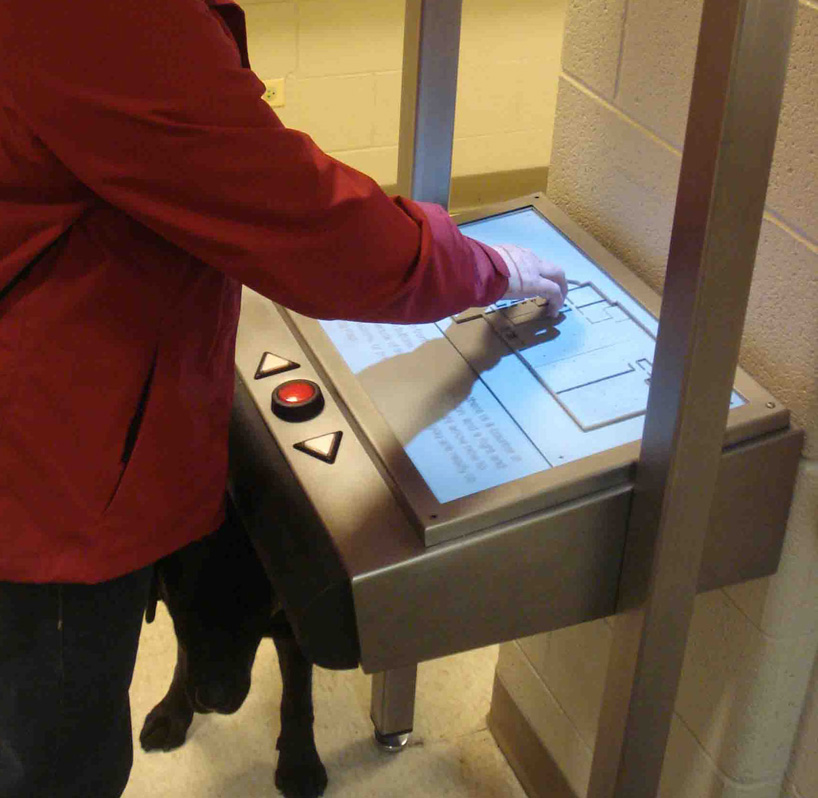
the 3-dimensional plans enables the visually impaired to independently navigate around public space
MAP ART AND DESIGN (56)
 Jul 23, 2023
 Jul 29, 2022
 Nov 06, 2021
 Jun 13, 2021
 May 30, 2021
PRODUCT LIBRARY
 Mar 21, 2024
 Mar 13, 2024
 Feb 24, 2024
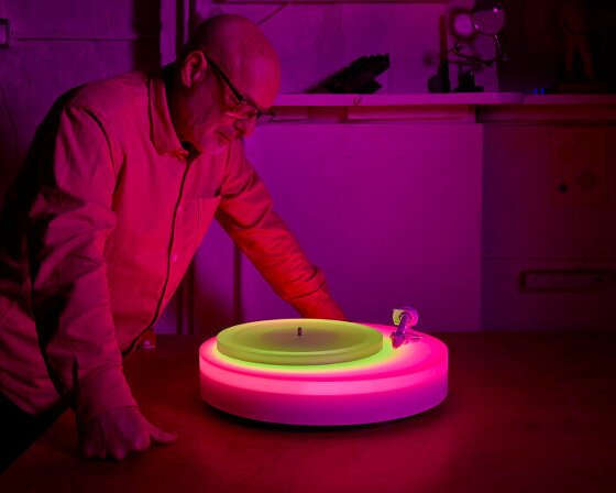 Feb 07, 2024