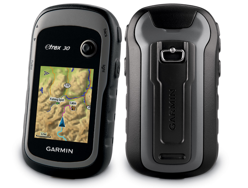
the ‘etrex 30’, one of three new GPS units by garmin
three new redesigned handheld GPS units in garmin‘s ‘etrex’ line offer compact, durable navigation outdoors, with features specifically designed for geocachers.
all three devices feature an improved interface and up to 25 hours of battery life on 2 AA batteries. geocaching locations and GPX files can be downloaded directly to the unit via USB, where the device stores key information about the terrain and location. the rounded design and rugged materials increase the unit’s durability.
the ‘etrex 10’ features a monochrome display, while the ‘etrex 20′ and ’30’ use a 2.2-inch colour screen, all readable in sunlight. ‘etrex 20′ and ’30’ both offer topographic, marine, and road maps, sold separately, that let the models double as consumer navigation devices.
garmin’s ‘basecamp‘ utility for the ’20’ and ’30’ models offers users an easy way to plan and manage trips, as well as view topographic maps in either 2D or 3D. a ‘track draw’ feature lets hikers trace their intended route and see an immediate elevation profile to determine the difficulty of their path, or to playback traversed routes. geotagged photos can also be added to any waypoint on the map.
additionally, the ‘etrex 30’ includes a barometric altimeter, unit-to-unit data transfer with compatible devices, and a built-in 3-axis electronic compass that is tilt-compensated so does not need to be held level.
all three devices are expected to be available in autumn of 2011, at a retail price of 120 USD, 200 USD, and 300 USD for the ’10’, ’20’, and ’30’ models respectively.
 detail view of the rugged-designed device
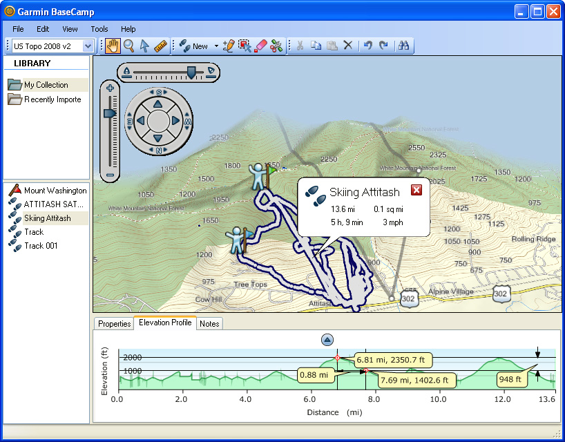 updated ‘basecamp’ software (screenshot taken from original version, in 2009) joins the hardware redesigns image courtesy of gpsfix
via engadget
PRODUCT LIBRARY
 Apr 22, 2024
 Mar 21, 2024
 Mar 13, 2024
 Feb 24, 2024