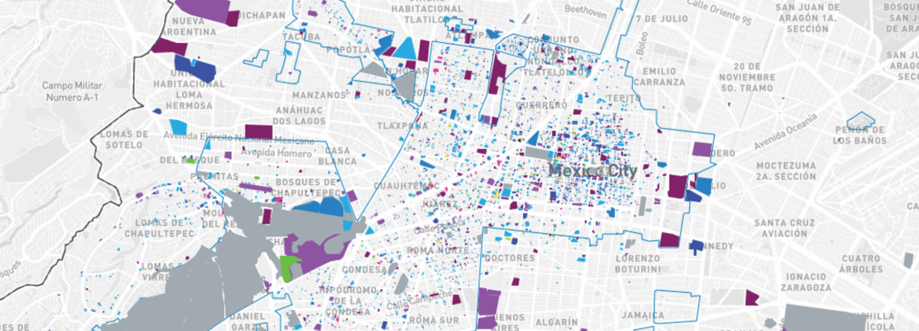
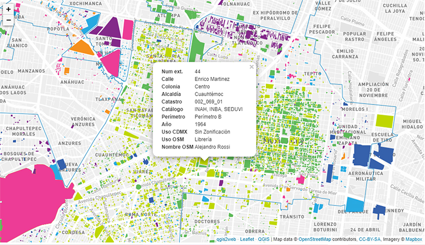
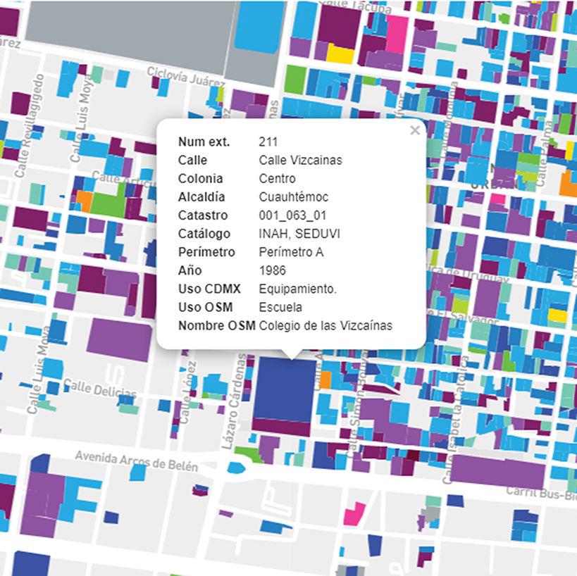
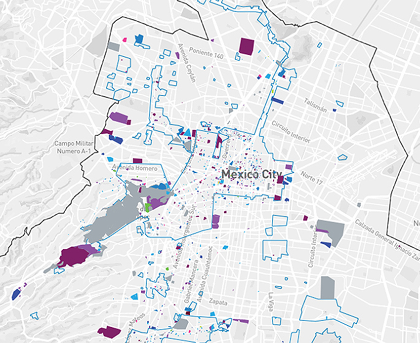
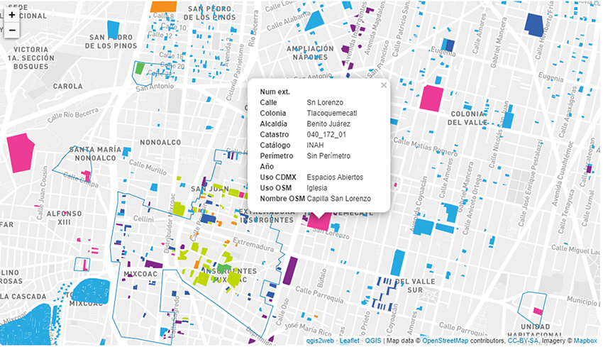
cartografias del patrimonio es is a digital platform created by sophie davin and lucia villers davin, that contains navigable maps with all the public information about the architectural, urban, and natural heritage of mexico city. thanks to the public data on the web, you can approach each property in each of the maps and consult information such as: its use registered in google maps, which institution catalogs it, or the year in which the latest remodeling was registered.
all images courtesy of cartografias del patrimonio
cartografias del patrimonio‘s aim was to visualize the information available on heritage in cartographies and in a unified way for the entire city. they used open databases from the mexico city open data portal, the mexico city geographic information system, and open street maps, the INAH (national institute of anthropology and history), the INBA (national institute of fine arts) were used. fine arts) and SEDUVI (secretary of urban development and housing).
this information was curated to be viewed by themes: catalogs; organized according to the institution that protects them. perimeters; perimeter a or b of the historic center, according to the decree declaring a zone of historic monuments. uses of open street maps: according to the uses registered in this database free download. mexico city land use: organized from the land uses of the urban development programs of mexico city. year: organized from the year of its construction or its last remodeling. public space/building: the public space includes urban public areas, such as squares, parks, or gardens, as well as large green areas of conservation. on the other hand, in the building group, all the properties have architecture classified as heritage.
architectural heritage is of great importance for society, students, researchers, academics, and professionals related to the historical heritage. for this reason, the free consultation of the maps, as well as the free download of the work, is available for anyone who has interests related to this project. this web page is supported by the system of supports for the creation and cultural projects (FONCA)
project info:
name: cartografias del patrimonio
designers: sophie davin and lucía villers
designboom has received this project from our ‘DIY submissions‘ feature, where we welcome our readers to submit their own work for publication. see more project submissions from our readers here.
edited by: yasmina karam | designboom
map art and design (57)
 Jul 26, 2024
 Jul 23, 2023
 Jul 29, 2022
 Nov 06, 2021
 Jun 13, 2021
PRODUCT LIBRARY
 Jul 15, 2024
 Jul 09, 2024
 Jul 09, 2024
 Jun 20, 2024