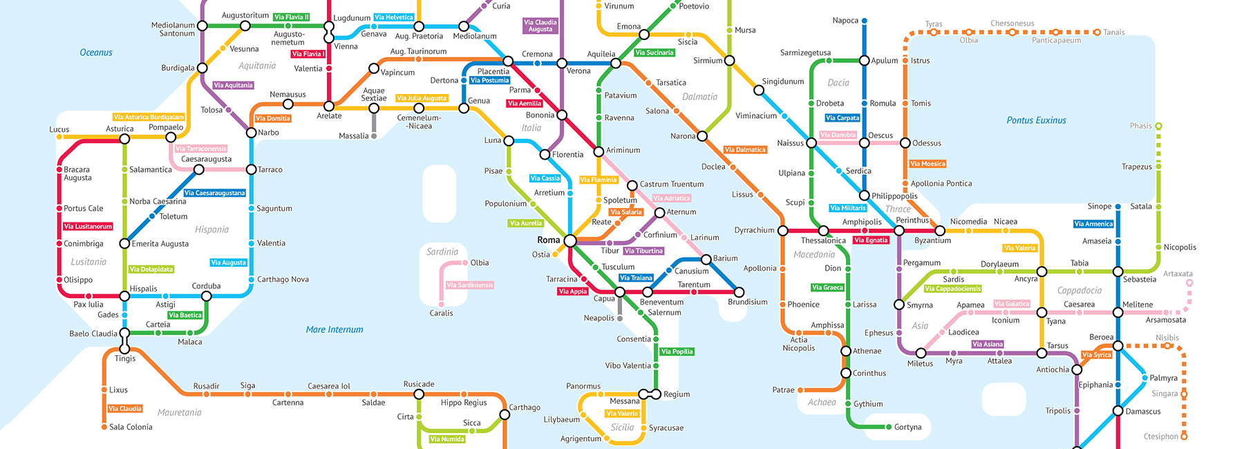
as the saying goes, all roads lead to rome — but it’s not that easy to imagine the actual scope and size of the romans’ vast empire and its intricate interconnectivity. sasha trubetskoy — a statistics major at the university of chicago and self-described ‘geography and data nerd’ — has undertaken the task of condensing the immense network into a graphic that can be easily and quickly understood. after weeks of research across a range of historical sources, trubetskoy designed a subway-style map of the major roman roads, based on the empire of CA. 125 AD.
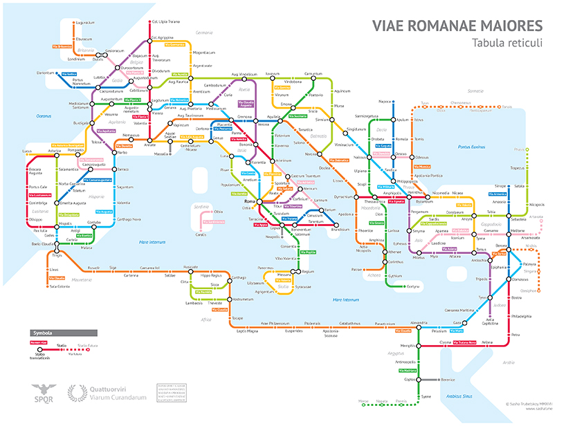
the subway-style map of major roman roads is based on the empire of CA. 125 AD
trubetskoy’s diagram depicts the important stops and transfer points along the routes — just like a subway map does. lines are organized by color, indicating their course across land. the routes are a combination of authentic, named roads — like via appia or via militaris — and pathways that did not have a known historic name — which trubetskoy notes were creatively invented for the purpose of the graphic. trubetskoy recounts the creation process and liberties taken in great detail, indicating that it was the empire’s enormous size that posed the largest problem: ‘the biggest creative element was choosing which roads and cities to include, and which to exclude. there is no way I could include every roman road — these are only the main ones.’
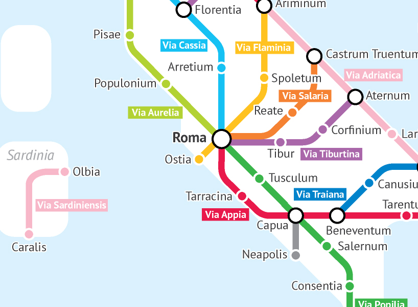
the lines are a combination of authentic, named roads — like via appia or via militaris
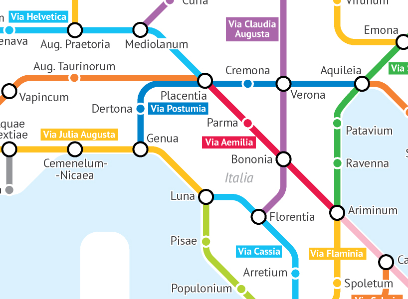
lines are organized by color, indicating their course across land
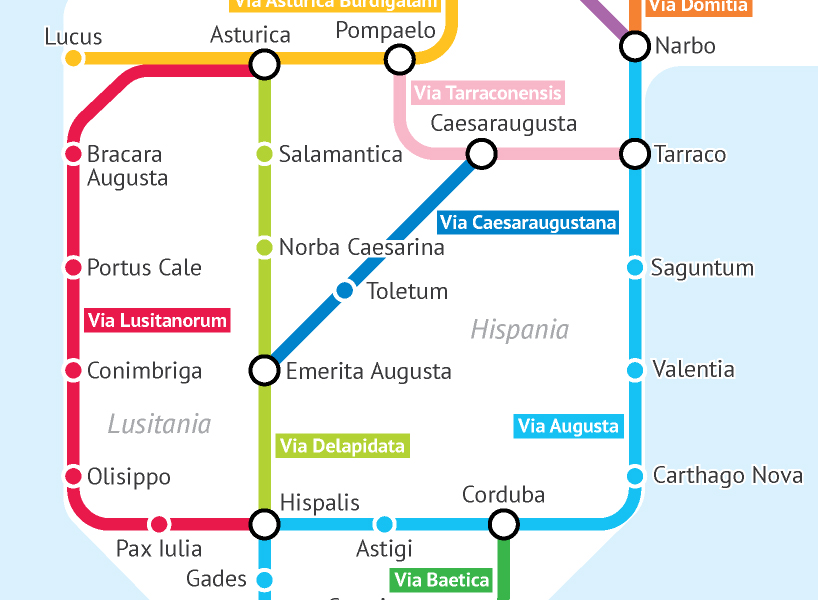
trubetskoy notes that the names of some lines were creatively invented for the purpose of the graphic
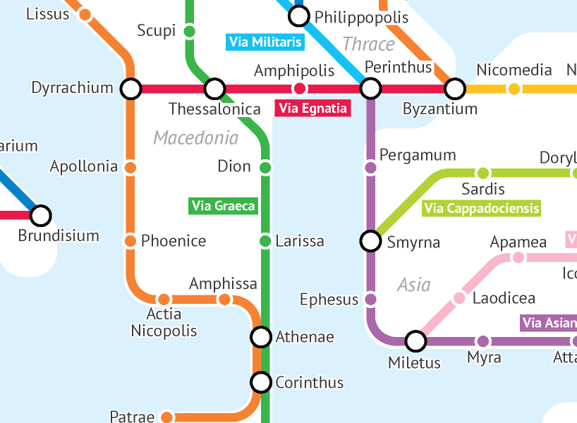
the red line — via egnatia — was a road constructed by the romans in the 2nd century BC
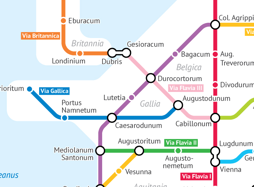
the diagram depicts the important stops and transfer points along the routes
map art and design (57)
 Jul 26, 2024
 Jul 23, 2023
 Jul 29, 2022
 Nov 06, 2021
 Jun 13, 2021
PRODUCT LIBRARY
 Oct 18, 2024
 Oct 12, 2024
 Sep 28, 2024
 Sep 11, 2024