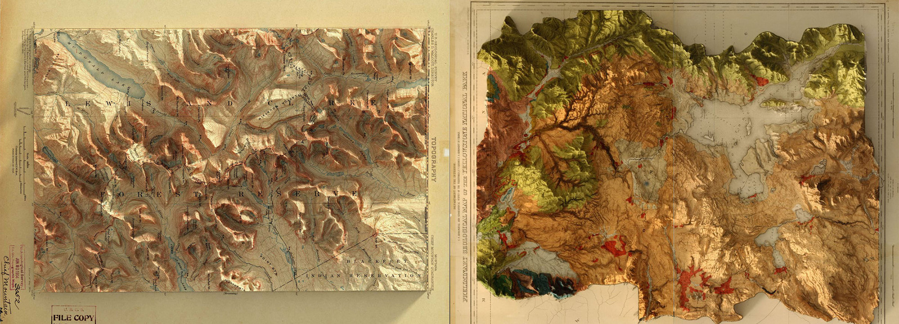
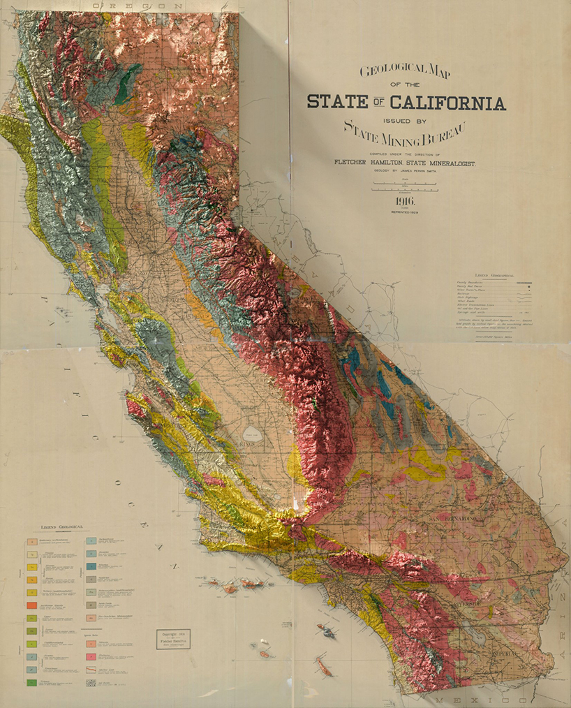
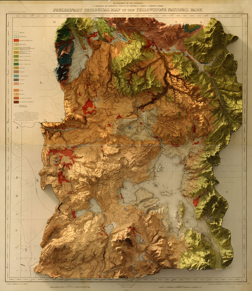
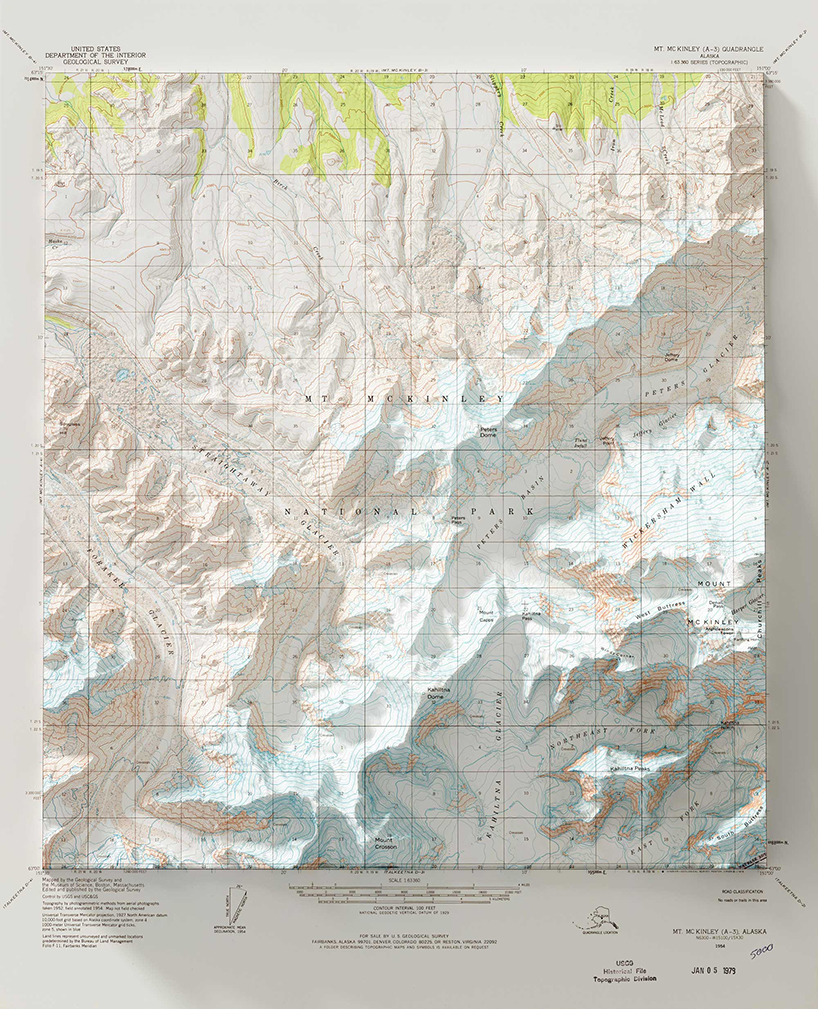
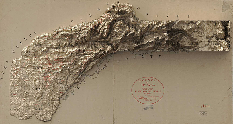
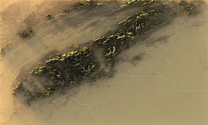
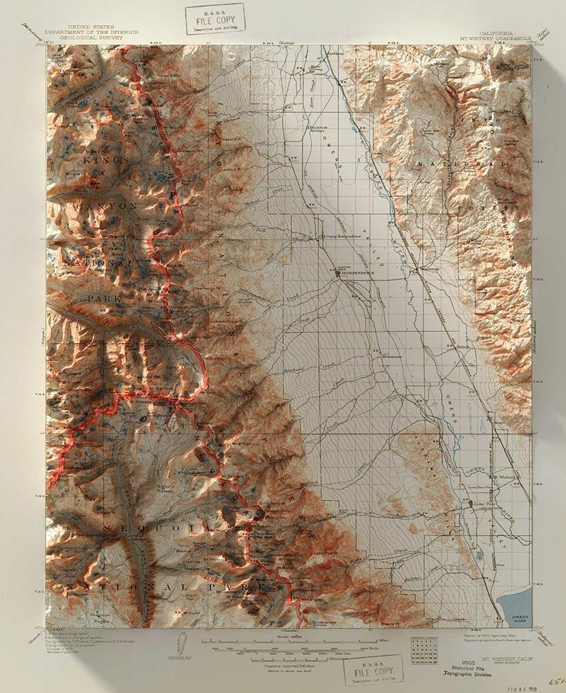
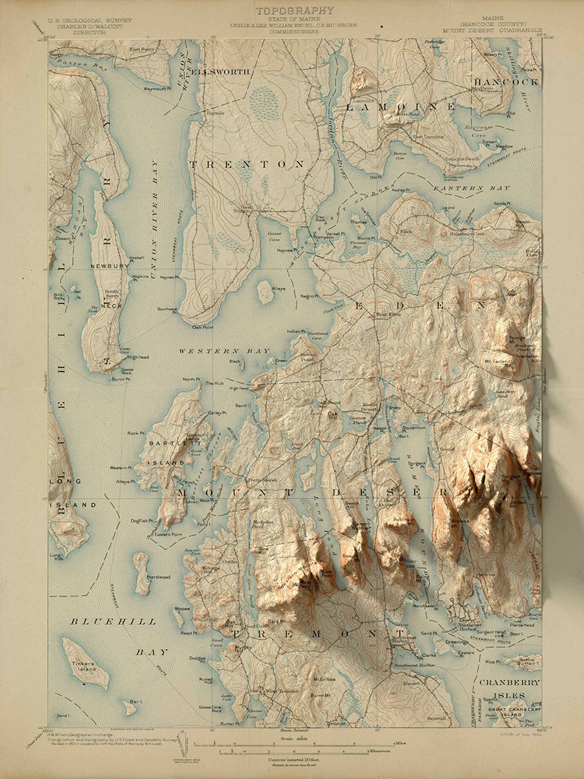
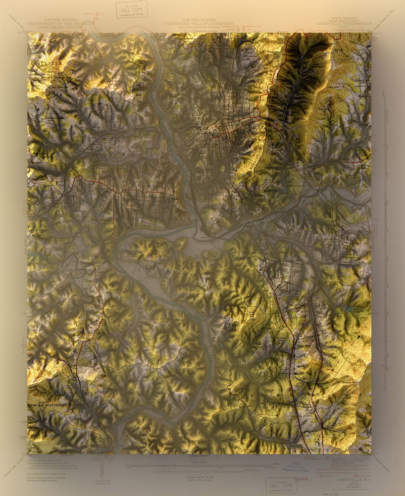
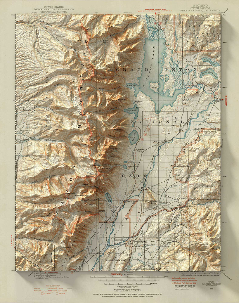
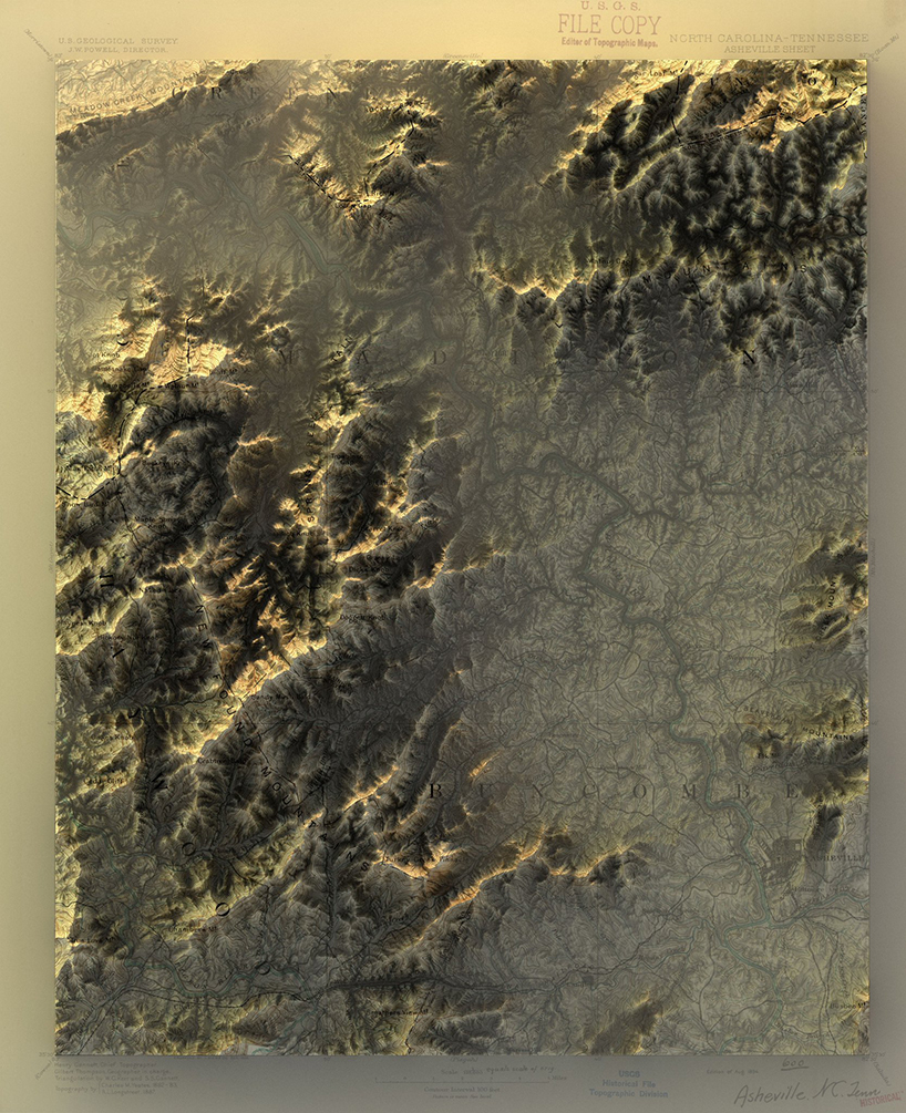
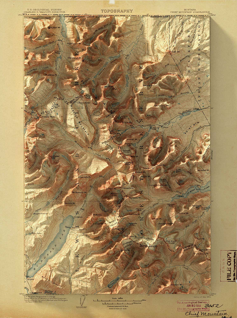
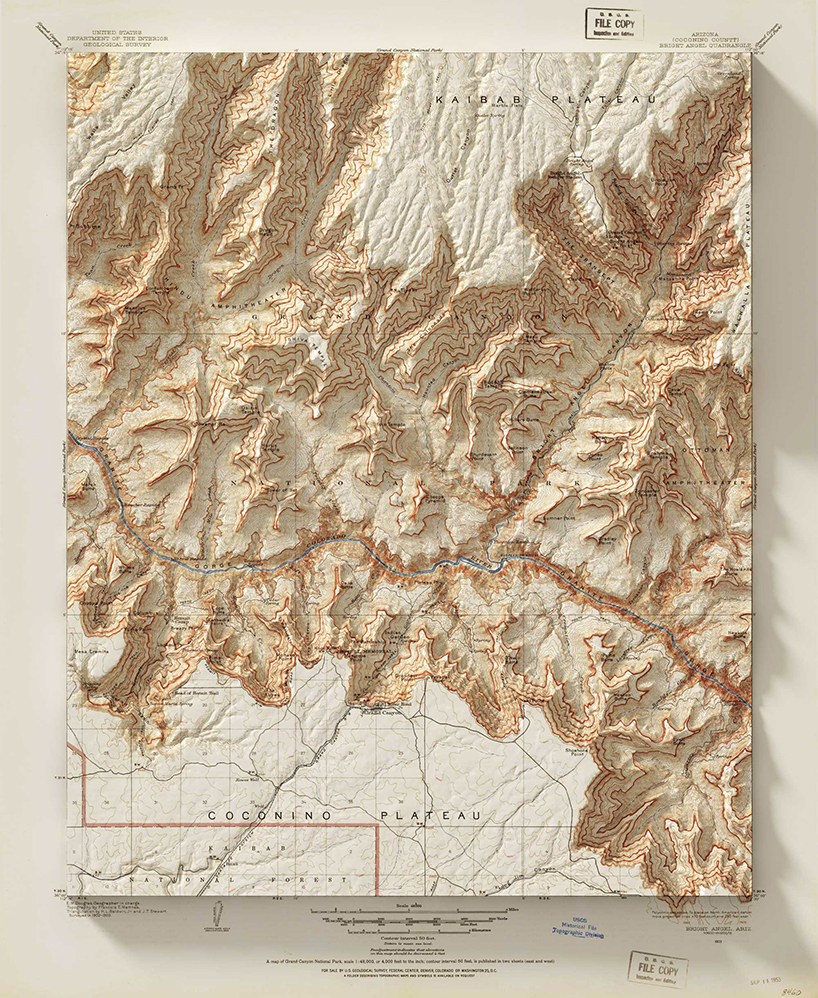
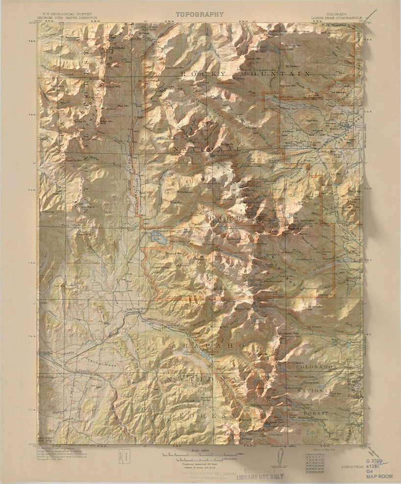
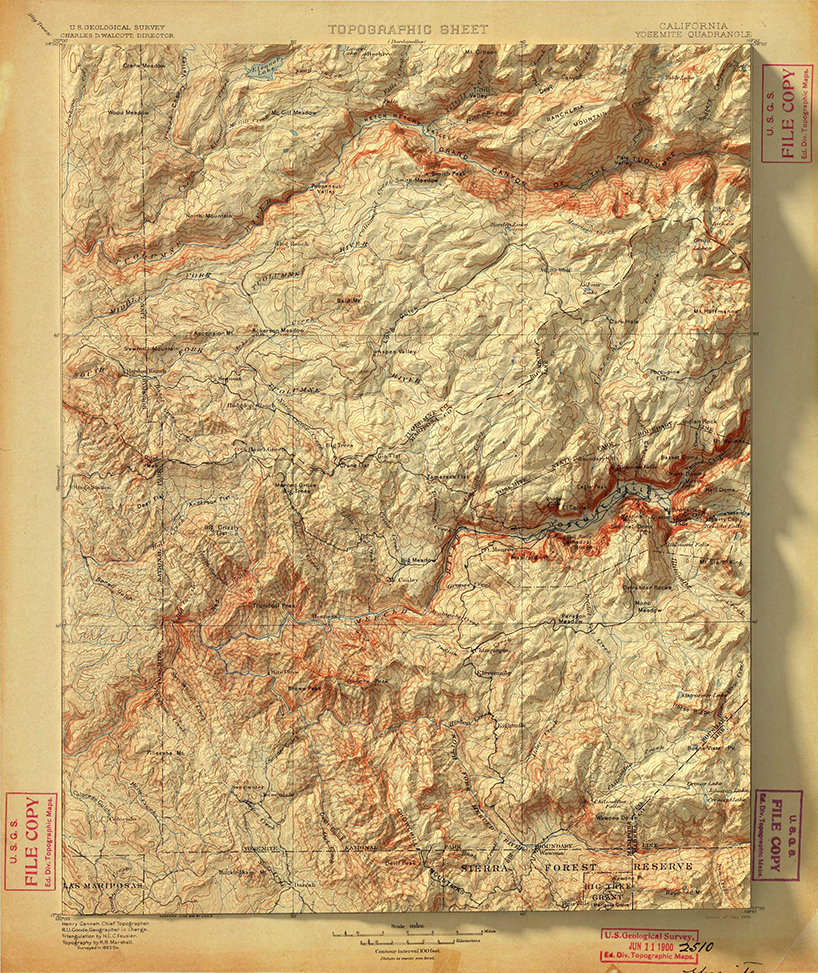
scott reinhard digitally renders 3-dimensional elevations onto vintage maps. on the 1916 USGS state mining bureau map below, digital shadows ripple the paper and trick our eyes into learning the landscape. the 1878 yellowstone national park map unfolds treacherous passes and rivers that exist in life, but could never have been emphasized enough until modern elevation data and digital editing techniques.
all images courtesy of scott reinhard
each geological survey map below started as a shadowless, handmade document. then, with elevation data in hand, reinhard goes to work. his maps are for sale on his website and he posts new projects pretty regularly on his instagram alongside the occasional puppy photo.
KEEP UP WITH OUR DAILY AND WEEKLY NEWSLETTERS
MAP ART AND DESIGN (56)
 Jul 23, 2023
 Jul 29, 2022
 Nov 06, 2021
 Jun 13, 2021
 May 30, 2021
PRODUCT LIBRARY
 Apr 17, 2024
we're getting ready for the pre-opening launching today until friday, with public access scheduled for the 20th.
connections: 6
 Apr 09, 2024
designboom speaks with french artist JR about la nascita, his new monumental rock installation just outside milan central station.
 Mar 27, 2024
the 'poet of iron', as dubbed by his colleagues, passed away at his home in orient, new york, after a battle with pneumonia.
connections: +110
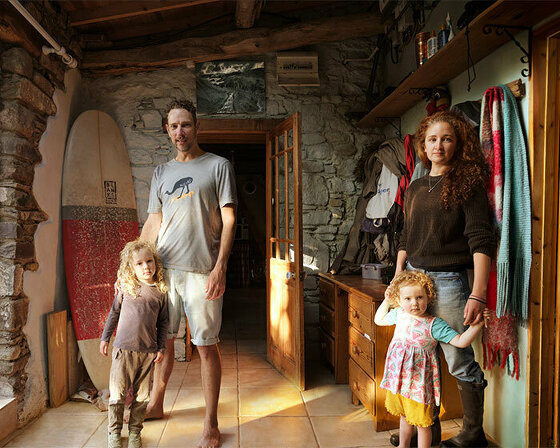 Feb 29, 2024
renowned photographer annie leibovitz, IKEA's first-ever artist in residence, unveils 25 powerful portraits of family life from stockholm to tokyo.
connections: +480