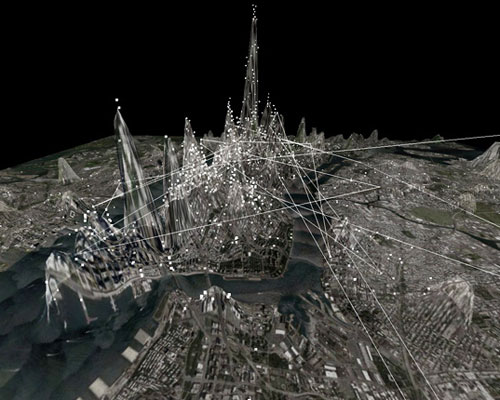
invisible cities visualizes social networks around the world
through an immersive, three-dimensional information landscape, geocoded activity from online services such as twitter and instagram are displayed in real-time.
invisible cities visualizes social networks around the world
all images courtesy of invisible cities
‘invisible cities’ developed by seattle-based schema design visualizes the social networks in the urban environment. displaying geocoded activity from online services such as twitter and instagram in real-time and aggregate, the information is represented as individual nodes that appear whenever a message or image is posted. these communication channels are reflected in the underlying terrain: over time, the landscape warps as data is accrued, creating hills and valleys to show areas with high and low densities.
version 1.0 of ‘invisible cities’ is now available for the leap motion controller and supports a wide variety of gestures for navigating the visualization. you can download it free on airspace, the leap motion marketplace.
‘invisible cities for leap’
video courtesy of schema design
nodes are connected by narrative threads, which are based on themes emerging from the overlaid information. these pathways create dense meta-networks, blanketing the terrain and joining disparate areas of the city. through an immersive, three-dimensional information landscape, the piece creates a parallel experience to the physical environment, one of intersections, discovery, and memory.

zooming in on a tweet

tokyo with tweet highlighted

the timeline allows you to go back in time up to 24 hours

a concert in New York City
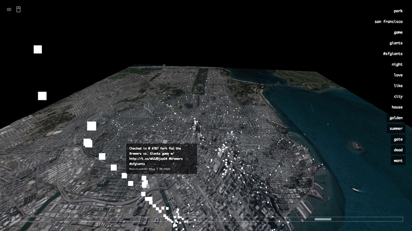
during the game in San Francisco
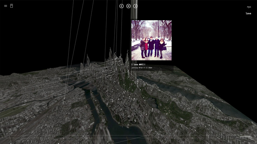
instagram photo in new york with topic highlighted

instagram photo visualized
https://www.schemadesign.com
shop
your own online design shop — no sales commission collected