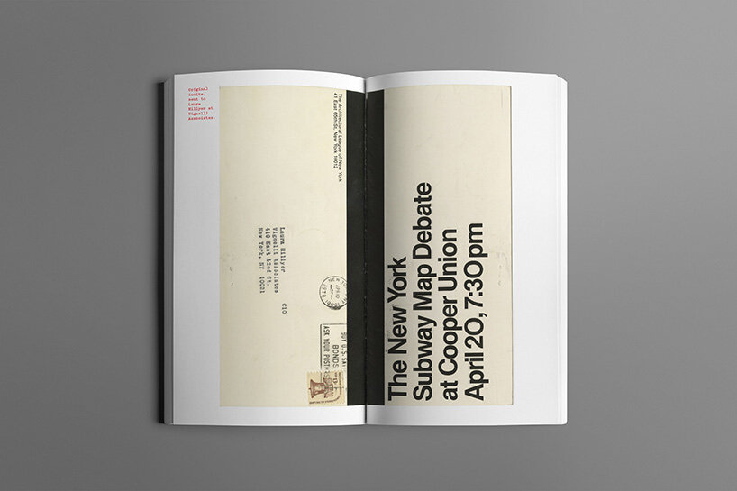
looking at a new york city subway map today might not necessarily conjure up visions of a highly contentious and controversial design debate — but in 1978, that’s exactly what went down one april evening at the cooper union. the crux of the now-legendary dispute centered around a battle between the minimalist, graphically-gratifying 1972 map by creative force massimo vignelli, and the more contextual, geographically-accurate map proposed by cartographer john tauranac. architects, designers, city officials, and ordinary new yorkers attended the debate and weighed in with their considerations and concerns about the future of the new york city subway map in a lively conversation thought to be lost to history.
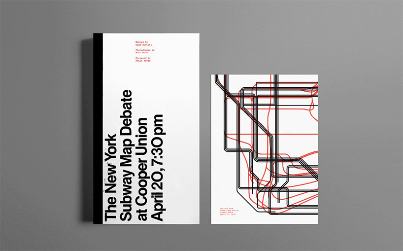
it was a ‘wonderful coincidence’ then, when filmmaker and design historian gary hustwit got his hands on the lost two-hour long audio recording of the event, which captured this pivotal moment in design history. in his research, hustwit also unearthed unpublished footage by a photographer named stan ries who had been there that night and captured the scene in its controversial and creative glory. these exceptional images and the audio transcript from the event has now been edited into a 140-page publication, edited by hustwit, and aptly titled, the new york subway map debate. ‘I just love the idea of publishing a whole book about a two hour conversation that happened 43 years ago,’ hustwit tells designboom.
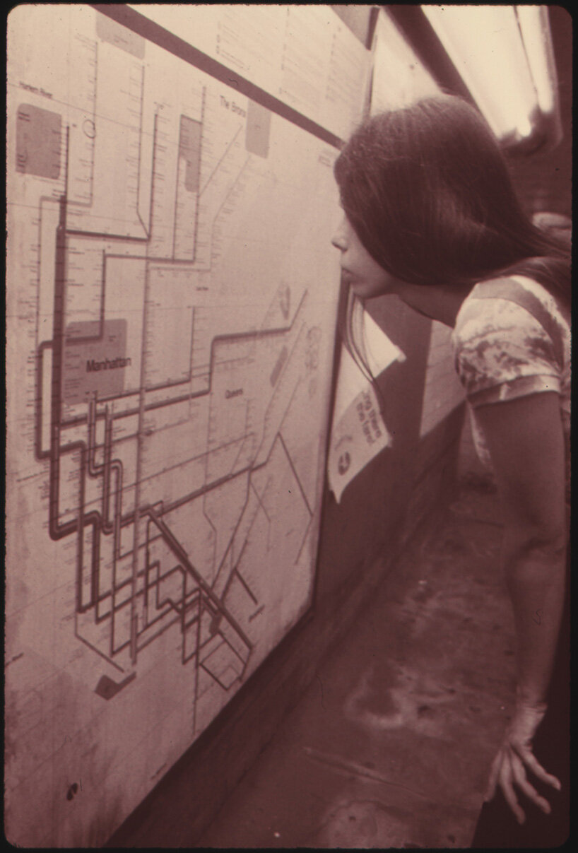
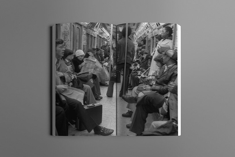
a woman looks at a route map of the new york city transit authority subway system in 1974
image from the national archives at college park, public domain, via wikimedia commons
to learn more about the evening surrounding this epic design dispute and the events that led to the publication of the new york subway map debate, designboom spoke with gary hustwit…
designboom (DB): what led to the discovery of this lost audio recording, and how did its finding develop into the publication of the new york subway map debate?
gary hustwit (GH): last summer, I was making a short documentary called ‘the map’, which followed work & co’s process of designing the new live subway map. it’s reacting to the actual conditions in the subway — you can see the trains moving, etc. — so, as part of my research, I was looking deeper into the history of the map. I’d heard about this infamous debate about the map that had happened between massimo vignelli and john tauranac at cooper union in 1978. but aside from a few short quotes in the new york times and new yorker from that era, there wasn’t any record of what was actually said in the debate.
gary hustwit: the new york subway map debate, published by standards manual
photographs by stan ries, copyright © gary hustwit, 2021
GH (continued): so, I spoke with the archivists at the cooper union, who coincidentally were in the middle of a major initiative to catalog and digitize an archive of over 4,000 reel-to-reel recordings of events that had taken place there from the 1940s to the 1980s. it was a massive amount of recordings that had been basically moved from one storage facility to another for the past 40 years. and it just so happened that when I spoke to them, they’d just discovered the subway map debate debate tape. so, it was a really strange and wonderful coincidence, and that’s when started thinking it would be interesting to publish the debate transcript.
gary hustwit: the new york subway map debate, published by standards manual
photographs by stan ries, copyright © gary hustwit, 2021
DB: can you briefly introduce the crux of the 1978 debate? who was in attendance, and what did their different voices contribute to the conversation?
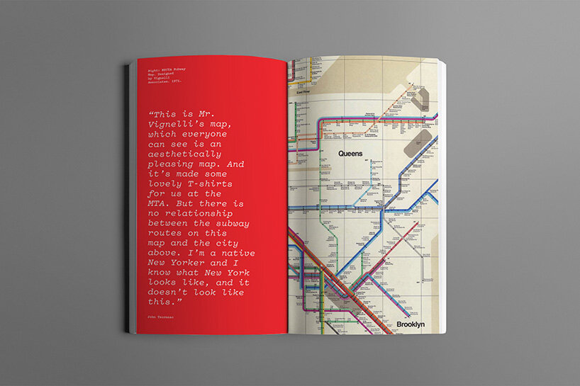
GH: well, the controversy goes back to the 1972 map, which vignelli associates designed. this was a few years after vignelli and bob noorda had overseen the redesign of the NYC subway system signage. the ’72 map, which vignelli executed along with a young designer named joan charysyn, was very minimal, reduced down to just the subway routes, 45- and 90-degree lines on a grid. very late-modernist. there were no street names, for instance, and vignelli moved the locations of certain stations so they’d fit into his grid. so it wasn’t connected to the geographic reality of the city, vignelli didn’t intend it to. but in his defense, there were supposed to be two other maps available in the stations, including a geographic map of the city, but the metropolitan transportation authority (MTA) apparently didn’t produce them.
you have to remember the economic crisis that NYC was going through in the ’70s: the transit system was a mess. so, as beautiful as vignelli’s map was, subway riders apparently were confused by it, and people complained.
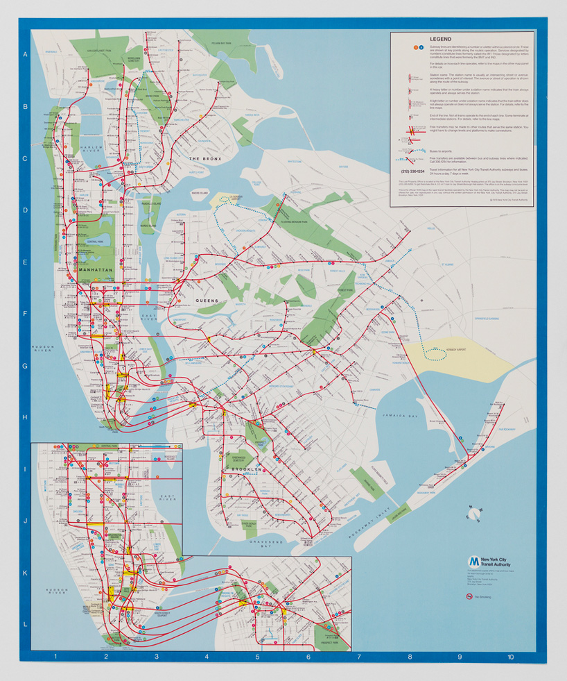
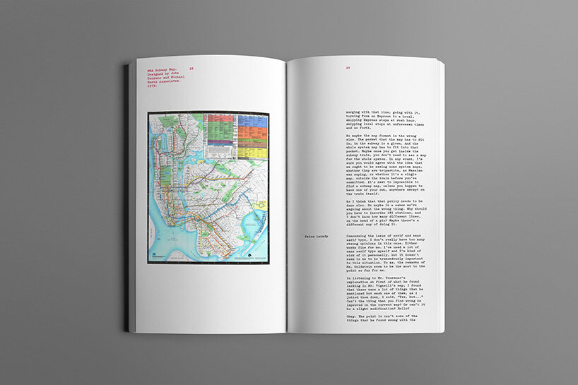
poster, prototype for new york city subway map, 1978 | image courtesy of cooper hewitt
designed by michael hertz associates (new york, new york, USA); USA
offset lithograph on white wove paper; 70.5 × 57.8 cm (27 3/4 × 22 3/4 in.) gift of unknown donor; 1987-24-1
info: in the 1978 prototype, michael hertz associates added new york streets and landmarks. hertz kept vignelli’s colors as circular bullets, but rendered all subway lines in red, which users found confusing. later iterations, as well as today’s map, use a ‘trunk line’ color coding system, with one color assigned to each avenue of operation.
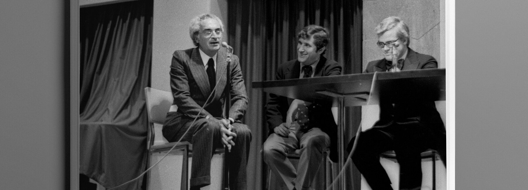
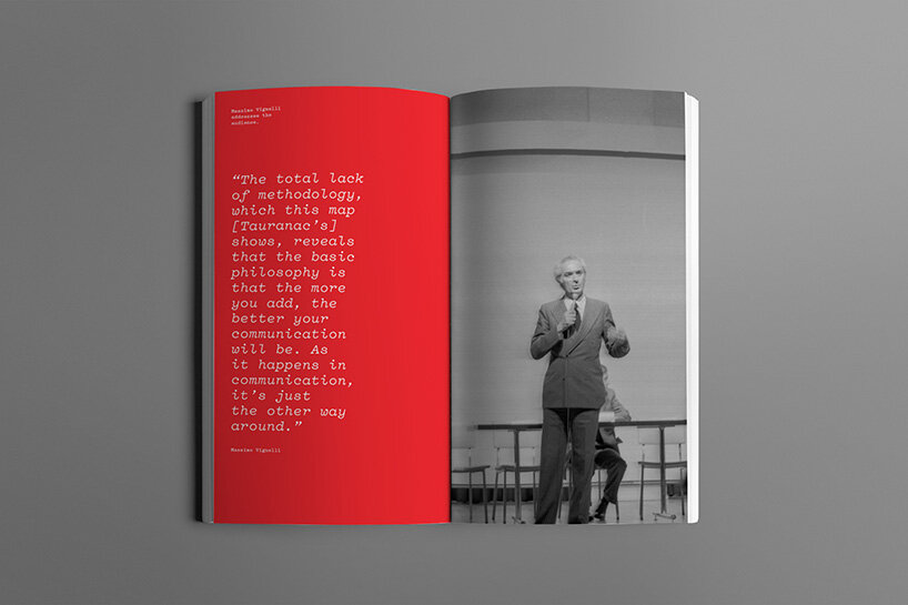
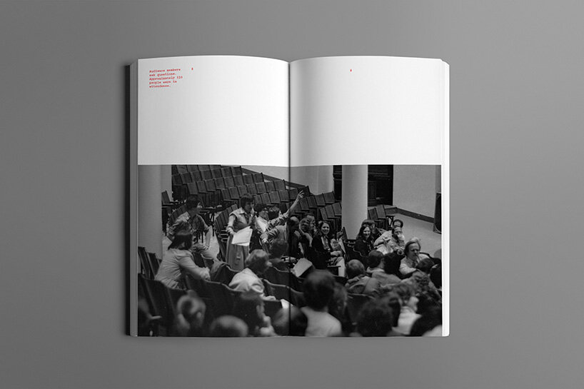
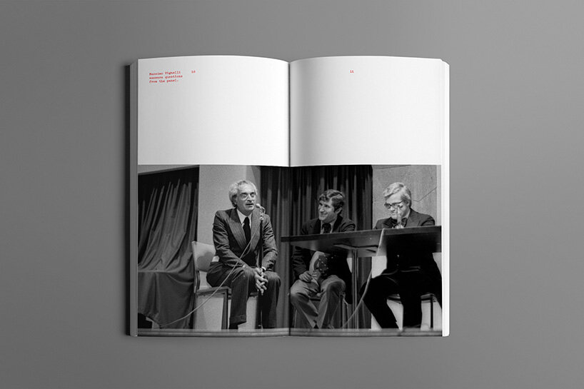
GH (continued): a movement started within the MTA and among people who were critical of the map and wanted to replace it. john tauranac, a cartographer who became the head of the MTA map committee, pushed for a map with geographic accuracy and more contextual information about the city. the ’78 debate was basically tauranac unveiling his design, which had been executed by michael hertz associates, and vignelli stating his case for his own map. there was also a panel discussion with six other experts, graphic designers, and transit planners moderated by architect peter blake. the audience was made up of designers, architects, city officials, and ordinary citizens who just wanted to complain about the subway. it was an interesting crowd, and they were pretty vocal.
gary hustwit: the new york subway map debate, published by standards manual
photographs by stan ries, copyright © gary hustwit, 2021
DB: what personally fascinated you about that evening as you fed through the transcript? what do you think makes it such an interesting topic for a publication?
GH: I’m just a geek about this stuff, I guess. I mean, I’ve spent almost 20 years documenting design through my films and I’m still fascinated by this stuff. I’m obsessed with cities and I’m obsessed with graphic design, so the subway map controversy is a perfect storm for me.
but mostly, it was the idea that the content of the debate had never been made public. in my research, I also found a photographer named stan ries who had been there that night, and had taken dozens of photographs that had never been published. so, I had the lost tape and the unseen photos, and decided to track down the surviving debate participants and talk to them about their recollections of the evening. those interviews are interspersed throughout the debate text in the book, plus the photos and examples of all the maps. and I just love the idea of publishing a whole book about a two hour conversation that happened 43 years ago.
gary hustwit: the new york subway map debate, published by standards manual
photographs by stan ries, copyright © gary hustwit, 2021
DB: which arguments from the debate did you appreciate? did you come to any personal conclusions about the vignelli versus tauranac maps?
GH: I can see where both sides were coming from. I personally love how vignelli’s map looks, it’s an iconic piece of graphic design. but if I were a tourist in NYC in the ‘70s, with no smartphone, trying to get around the city using that map? it would be impossible. again, vignelli assumed the MTA would also be issuing a companion map, a geographical one, and it didn’t. so, it wasn’t really a level playing field to judge his map’s effectiveness. and tauranac just wanted a map that accurately showed the city, and had more information about the subway service, which trains ran at what times, etc.
simplicity versus complexity, abstraction versus realism.
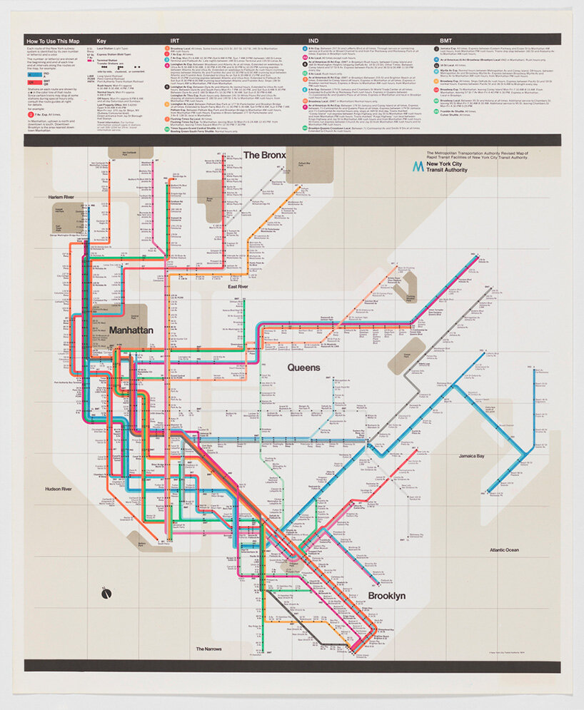
poster, new york city subway map, 1974 | image courtesy of cooper hewitt
designed by massimo vignelli (italian, active USA, 1931–2014); USA;
offset lithograph on white wove paper; 71.1 x 58.4 cm (28 x 23 in.); gift of unknown donor; 1987-24-2
info: in his 1974 new york subway map, massimo vignelli used an eight-color palette to communicate the complex system, assigning each line a specific color. critics found the diagrammatic plan too abstract, but many aspects of the design, including the color-coding of the lines, were retained in future iterations.
GH (continued): the MTA had already given tauranac’s new map their blessing before the debate. in 1979 it replaced vignelli’s, and 42 years later it’s still in use. but the arguments behind the debate are universal, and are still things that designers have to work through every day. how do you take complex information and make it communicable? the question remains the same whether we’re talking about the largest mass transit system in the world, or the most basic webpage.
gary hustwit: the new york subway map debate, published by standards manual
photographs by stan ries, copyright © gary hustwit, 2021
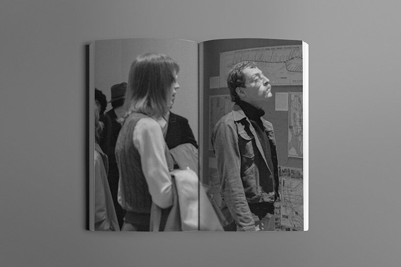
gary hustwit: the new york subway map debate, published by standards manual
photographs by stan ries, copyright © gary hustwit, 2021
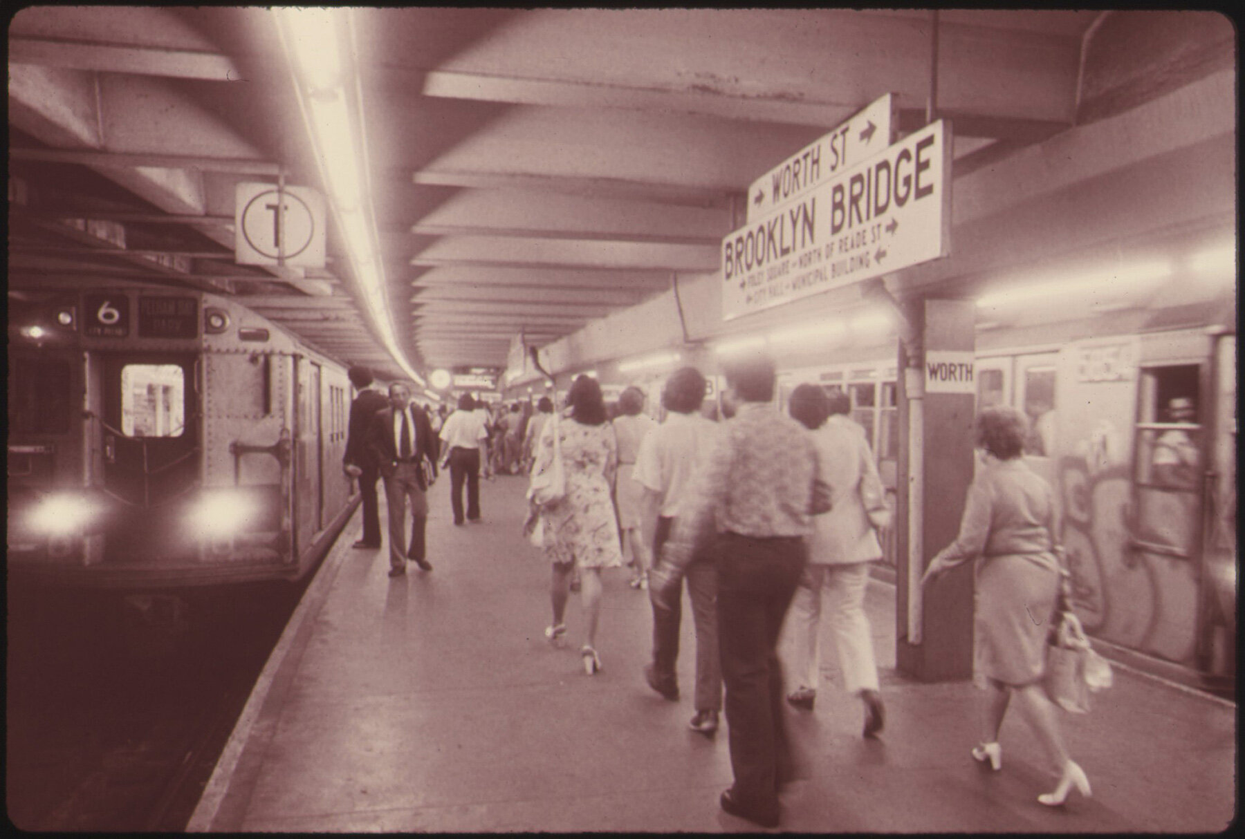
passengers and subway trains on the lexington avenue line of the new york city transit authority system in 1974
image from the national archives at college park, public domain, via wikimedia commons
gary hustwit: the new york subway map debate, published by standards manual
photographs by stan ries, copyright © gary hustwit, 2021
gary hustwit: the new york subway map debate, published by standards manual
photographs by stan ries, copyright © gary hustwit, 2021
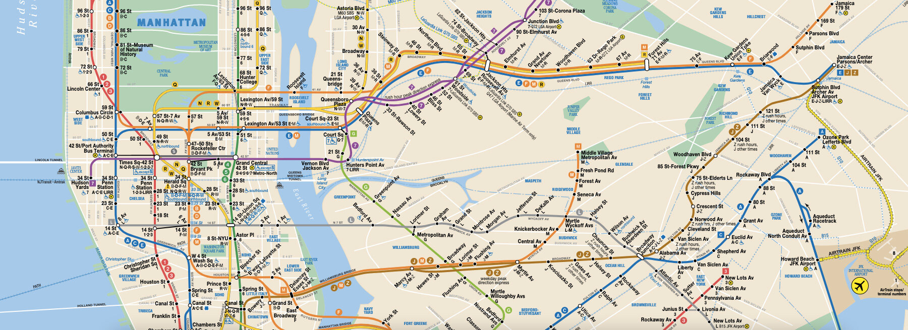
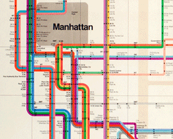
detail of the new york city subway today, courtesy of the MTA
gary hustwit: the new york subway map debate, published by standards manual
photographs by stan ries, copyright © gary hustwit, 2021
book information:
the new york subway map debate
book design: order
publisher: standards manual and gary hustwit
book editor: gary hustwit
foreword: pentagram designer paula scher
gary hustwit (3)

map art and design (57)
 Jul 26, 2024
 Jul 23, 2023
 Jul 29, 2022
 Nov 06, 2021
 Jun 13, 2021
massimo vignelli (8)
 Nov 03, 2018
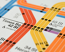 Jan 14, 2015
 May 27, 2014
 May 13, 2014
 Sep 30, 2010
subway architecture and design (27)
 Feb 02, 2022
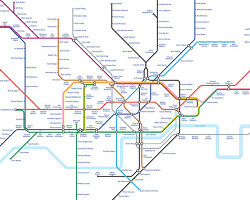 Oct 15, 2021
 Jul 19, 2021
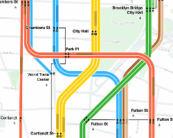 Oct 22, 2020
 Sep 02, 2020
PRODUCT LIBRARY
 Jul 23, 2024
 Jul 01, 2024
 Jun 13, 2024
 Jun 06, 2024