
THE WORLD AT YOUR FINGERTIPS by AS from france
designer's own words:
Driving is about travelling, exploring, discovering the world. What else brings us as simple, as fast and as close to the most beautiful places on this earth ? Travelling is and has been the subject of many important authors in the past until today including Goethe, Franz Kafka, Jack Kerouac, Haruki Murakami, to note just a few. But how can we discover the earth in another way ? Can we give access to the landscapes of our planet to people that are not able to drive and experience it with their own eyes ? What if we could make them travel the world, very simply, by the sense of touch ? « The world at your fingertips » is a proposal for an interactive device which allows people to travel the world by the glimpse of a touch.
The idea for the project came by a personal interest for digital elevation models. The Shuttle Radar Topography Mission (SRTM) is an international research effort that obtained digital elevation models on a near-global scale to generate the most complete high-resolution digital topographic database of Earth. SRTM consisted of a specially modified radar system that flew on board the Space Shuttle Endeavour. The question now was how to turn this amazingly beautiful data into a physical, dynamic model, an interactive device, which translates data into reality, and which makes it possible to communicate information by the sense of touch.
The device consists of a system of small pneumatic cylinders which translate the data of a digital elevation model of the world (e.g. Google earth) into a dynamic 3-dimensional analog elevation model. A world map that can be touched. Automatically updating every 1/20 second, the system adapts to the changes and movements in the digital model in real-time. A Tablet Computer is used to communicate in between the device and the user, and thanks to a voice user interface, visually handicapped persons can navigate themselves and « travel » autonomously. The user only has to indicate the place he wants to visit, the model will then automatically "build" the terrain, the scale can be changed to zoom in and out. The small polycarbonate poles are the « pixelised physic representation » of the digital elevation model. A lacquered cylinder-shaped frame covers the heart of the system, an array of pneumatic cylinders which are monitored by a compact computer hidden inside, which is connected via wifi to the tablet.
title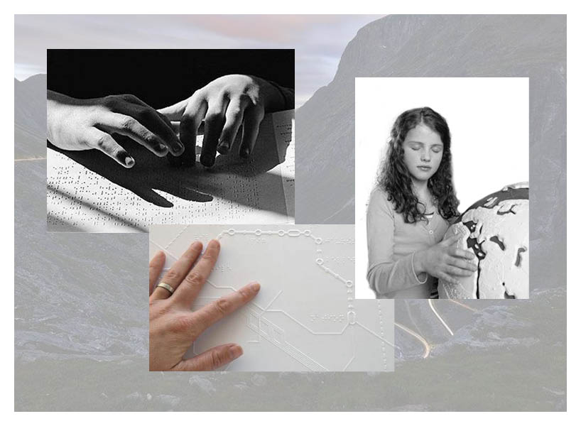
visually impaired people concentrate a lot more on the sense of touch to discover what surrounds them. what if we help them discover the world?
http://youtu.be/CjbqUPhqLQg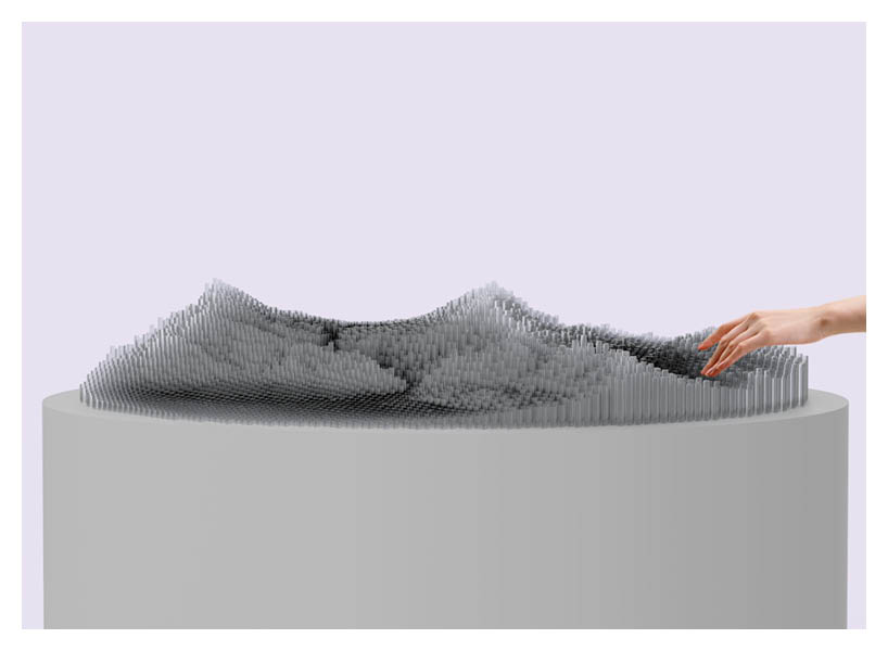
side elevation of the device in operation.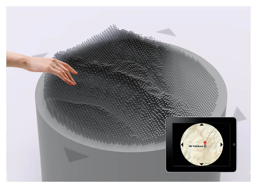
perspective of the device in operation, a tablet computer enables to communicate with the device: when moving inside the digital map on the tablet, the analog 3d elevation map adapts in real-time.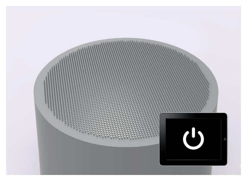
device turned off.