the ‘DIY streetview’ system lets users create their own ‘google streetview’-style interactive maps
developed by german designer jan martin, ‘DIY streetview‘ lets users create their own ‘google streetview’-style interactive maps as they walk around buildings, cities, or wilderness. not affiliated with google, the system offers opportunities not only within the tourism and real estate industries, but also for crisis response, transit system services, and universities and malls.
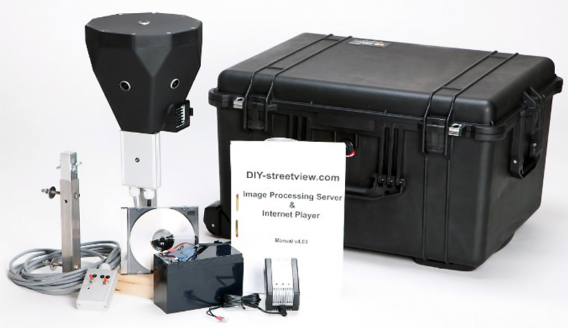
carried by hand, backpack, or car mount, the six-sensor, 30-megapixel camera covers 360 by 165 degrees, generating images that measure 7500 by 3750 pixels. photographs are automatically captured every 2 seconds, with its built-in GPS receiver and orientation sensor capturing extra data used later to stitch together the panoramas. explorers can also use their own GPS receiver and retag the streetviews after capture for increased accuracy.
in addition to offering an interactive, explorable ‘street view’, the system creates google or open street map aerial maps based on its route. while the generated data cannot be uploaded to the google street view database, invididuals can embed the maps into their own sites, offering the chance to create interactive custom walks, building or city tours, or other concepts, including of areas that google maps cannot visit.
you can experiment with an interactive map created by ‘DIY streetview’ here.
 screenshot from an explorable town tour filmed with ‘DIY streetview’ – interact with it with the google map player
 example image photographed with ‘DIY streetview’
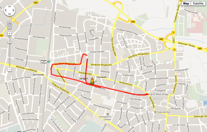 aerial map view automatically generated by the system
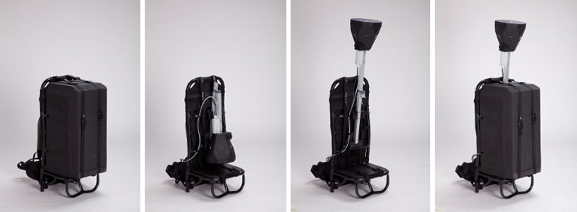 mounting and extension of the camera onto the optional backpack; martin has also developed a car mount
‘DIY streetview’ uses the google maps (and ‘open street map’) APIs but is not affiliated with either company. but you might be interested in some of the unusual streetviews and strange artistic interventions that google maps itself has been subject to!
via canada tech
PRODUCT LIBRARY
 Mar 21, 2024
 Mar 13, 2024
 Feb 24, 2024
 Feb 07, 2024