AR sandbox lets users shape lakes and create peaks through accurate simulation
all images courtesy of oliver kreylos
‘AR sandbox’ is an informal science eduction project for freshwater lake and watershed science that combines 3D visualization applications with an hands-on sandbox exhibit to teach earth science concepts. the augmented reality (AR) interface allows users to create topography models by shaping real sand, which is then in real time changed by an elevation color map, topographic contour lines and simulated water.
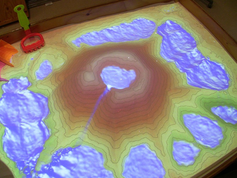
the augmented reality interface allows users to create topography models by shaping real sand
furthermore, ‘AR sandbox’ seeks to raise awareness and increase understanding and stewardship of freshwater lake ecosystems using an immersive platform. the project was created by the UC davis’ w.m. keck center of active visualization in the earth sciences, together with the UC davis tahoe environmental research center, lawrence hall of science and ECHO lake aquarium and science center.
immersive multimedia (88)
 Apr 16, 2024
 Apr 22, 2022
 Nov 25, 2019
 Nov 17, 2018
 May 20, 2017
PRODUCT LIBRARY
 Jul 22, 2024
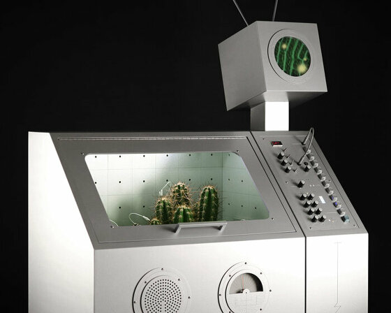 Apr 22, 2024
 Mar 21, 2024
 Mar 13, 2024